So you like our media brand Shift? You should join our Shift event track at TNW2020, where you’ll hear how data, autonomy, and connectivity are fueling the future of mobility.
This article was originally published by Sarah Wray on Cities Today, the leading news platform on urban mobility and innovation, reaching an international audience of city leaders. For the latest updates follow Cities Today on Twitter, Facebook, LinkedIn, Instagram, and YouTube, or sign up for Cities Today News.
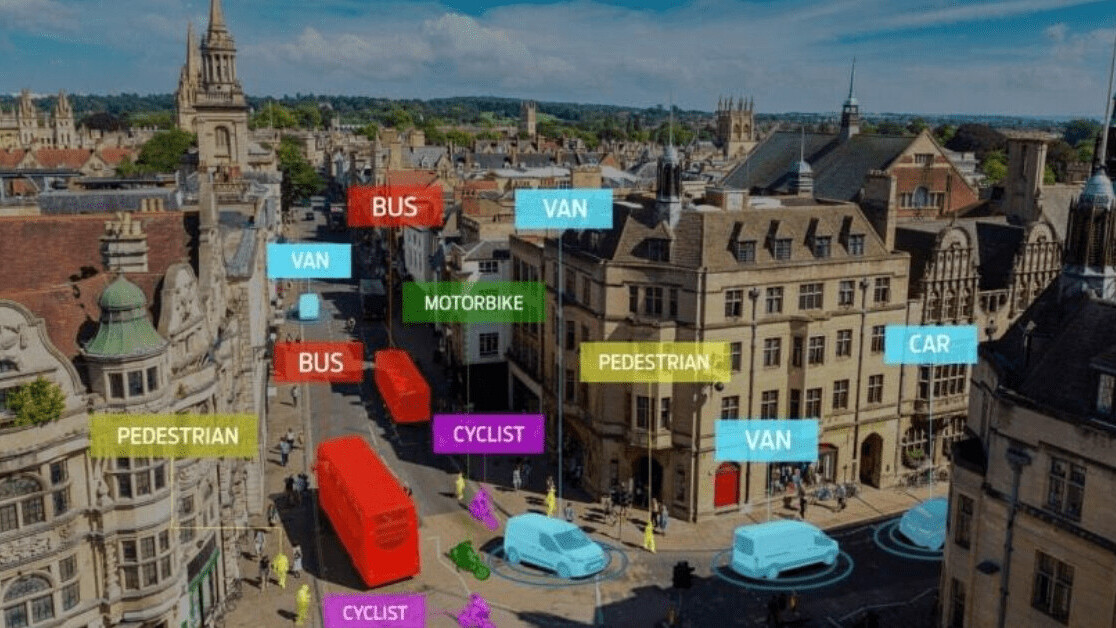
Ford is working with Oxfordshire County Council to develop a digital road safety tool which can predict potential road accident hotspots using data from sources such as connected vehicles and roadside sensors.
Each year more than 1.3 million people are killed in road accidents around the world. The solution aims to pinpoint the likely locations and possible root causes of roads and junctions that pose the highest risks, enabling cities to take pre-emptive action.
Up to 700 passenger and commercial vehicles will be voluntarily connected across Oxfordshire and London as part of an 18-month project. Detailed telematics data from the vehicles – such as brake or accelerator pedal usage and steering wheel angle – will be analyzed at the Transport Safety Research Centre at Loughborough University, alongside information from 100 Vivacity Labs sensors in Oxfordshire, which gather anonymous data on how road space is being used.
Oxfordshire County Council will focus on how local-authority-provided data sources, including information on road works and from traffic signals, can be combined with the predictive tool to improve road safety. The findings will also be shared with Transport for London.
The insights and analysis will be used to further test and develop Ford’s technology towards it becoming a commercial product.
“Oxfordshire County Council is committed to enabling innovative applications for connected vehicle technology that will benefit our communities,” said Llewelyn Morgan, Head of Innovation, Oxfordshire County Council. “By connecting vehicle data with smart infrastructure, we hope this project will help improve safety for all road users.”
Insights
The project has received funding from the government’s Innovate UK.
“Soon every new vehicle will be a connected vehicle, and we see this as an opportunity to reduce road traffic incidents and save lives in a significant way,” said Jon Scott, Project Lead, City Insights, Ford Mobility, Europe. “By collaborating with leading innovators, experts and academics – and with the backing of Innovate UK – we truly believe we can help improve mobility for millions around the world.”
The initiative follows two trials in London in which Ford Mobility analyzed data from more than 1.6 million kilometers of driving by connected vehicles. The findings suggested that relatively minor improvements could deliver results. Recommendations included the introduction of red-light cameras to deter signal jumping, cutting back vegetation to ensure road signage was clearly visible, double-height signage and signals, resurfacing carriageways and raising service covers.
Ford is also working with authorities in Cologne, Germany, and Valencia, Spain, on further analysis of information from connected vehicles and infrastructure to improve urban mobility and safety.
SHIFT is brought to you by Polestar. It’s time to accelerate the shift to sustainable mobility. That is why Polestar combines electric driving with cutting-edge design and thrilling performance. Find out how.
Get the TNW newsletter
Get the most important tech news in your inbox each week.


